
चित्र:Alaska Highway1.png
इस पूर्वावलोकन का आकार: ६१६ × ६०० पिक्सेल। दूसरे रेसोल्यूशन्स: २४७ × २४० पिक्सेल | ४९३ × ४८० पिक्सेल | ७८९ × ७६८ पिक्सेल | १,०५२ × १,०२४ पिक्सेल | २,०८३ × २,०२८ पिक्सेल।
मूल चित्र (२,०८३ × २,०२८ चित्रतत्व, संचिका का आकार: ५८ KB, माइम प्रकार: image/png)
सारांश
| विवरण |
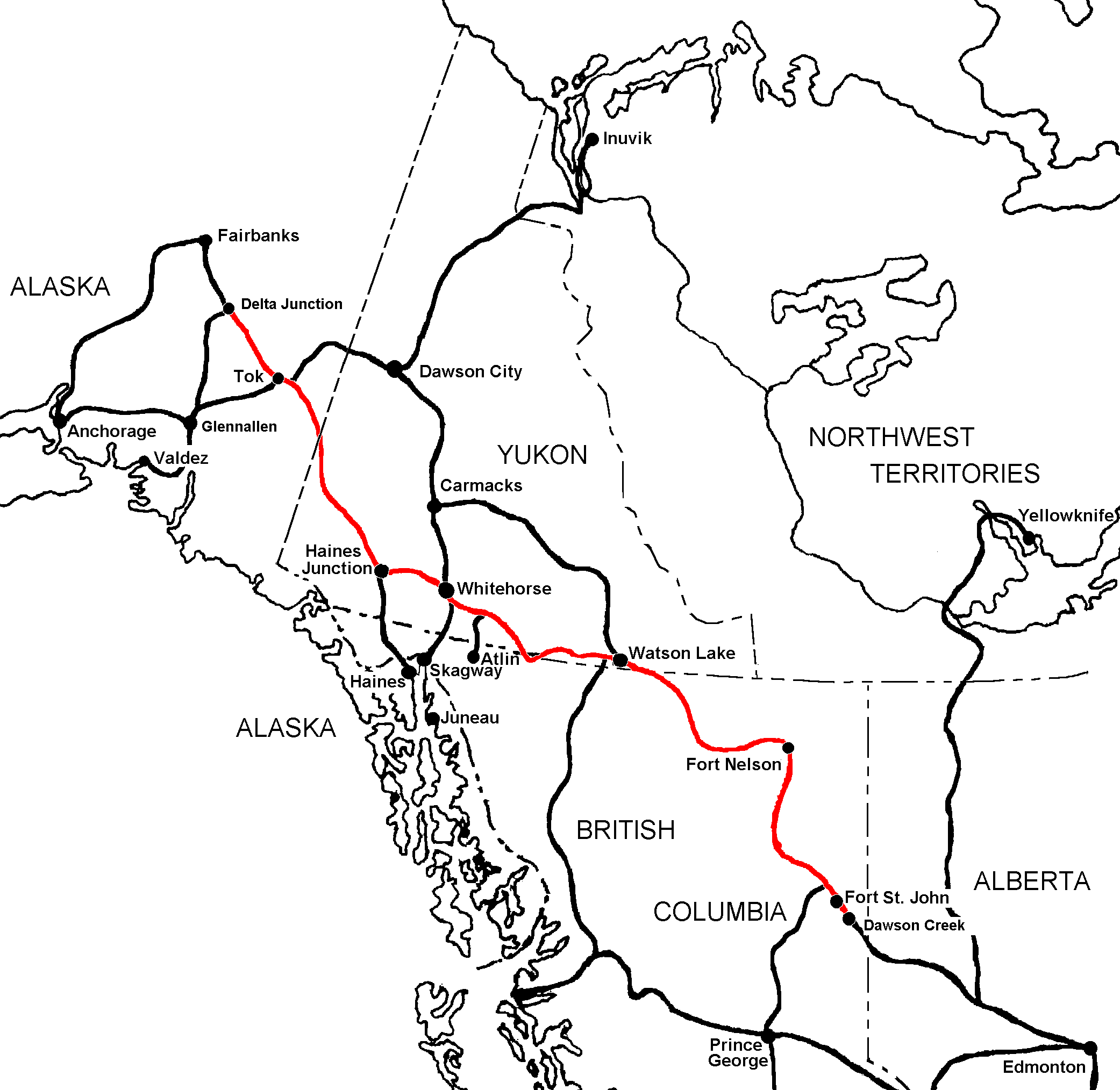
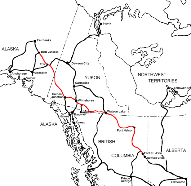
English: Map of Alaska Highway (in red) showing surrounding main highways and towns. |
| दिनांक | |
| स्रोत | अपना कार्य |
| लेखक | Luigi Zanasi |
| अनुमति (इस चित्र का पुनः उपयोग करना) |
I release it in the public domain |

|
This transport map image could be re-created using vector graphics as an SVG file. This has several advantages; see Commons:Media for cleanup for more information. If an SVG form of this image is available, please upload it and afterwards replace this template with
{{vector version available|new image name}}.
It is recommended to name the SVG file “Alaska Highway1.svg”—then the template Vector version available (or Vva) does not need the new image name parameter. |
लाइसेंस
| मैं, इस कार्य का/की कॉपीराइट धारक, इस कार्य को सार्वजनिक डोमेन में प्रकाशित करता/करती हूँ। यह पूरे विश्व में लागू होता है। कुछ देशों में यह कानूनी तौर पर नहीं हो सकता है; ऐसा हो तो: मैं सभी को इस कार्य का इस्तेमाल किसी भी उद्देश्य से, बिना किसी बाधाओं के इन शर्तों के कानून द्वारा अनिवार्य किए तक करने की अनुमति देता/देती हूँ। |
चित्र का इतिहास
चित्र पुराने समय में कैसी दिखती थी यह जानने के लिए दिनांक/समय पर क्लिक करें।
| दिनांक/समय | थंबनेल | आकार | सदस्य | टिप्पणी | |
|---|---|---|---|---|---|
| वर्तमान | ०७:०१, २४ जून २००६ | | २,०८३ × २,०२८ (५८ KB) | Luigizanasi | {{Information |Description=Map of Alaska Highway (in red) showing surrounding main highways and towns |Source=Own work based on a number of other highway maps using MS Paint & Irfanview for conversion. |Date=23 June 2006 |Author=Luigi Zanasi |Permission=I |
चित्र का उपयोग
यह पृष्ठ इस चित्र का इस्तेमाल करता है:
चित्र का वैश्विक उपयोग
इस चित्र का उपयोग इन दूसरे विकियों में किया जाता है:
- ar.wikipedia.org पर उपयोग
- be-tarask.wikipedia.org पर उपयोग
- be.wikipedia.org पर उपयोग
- bg.wikipedia.org पर उपयोग
- ca.wikipedia.org पर उपयोग
- cs.wikipedia.org पर उपयोग
- de.wikipedia.org पर उपयोग
- de.wikivoyage.org पर उपयोग
- en.wikipedia.org पर उपयोग
- en.wikibooks.org पर उपयोग
- es.wikipedia.org पर उपयोग
- eu.wikipedia.org पर उपयोग
- fa.wikipedia.org पर उपयोग
- fi.wikipedia.org पर उपयोग
- fr.wikipedia.org पर उपयोग
- gl.wikipedia.org पर उपयोग
- id.wikipedia.org पर उपयोग
- it.wikipedia.org पर उपयोग
- ja.wikipedia.org पर उपयोग
- ka.wikipedia.org पर उपयोग
- ml.wikipedia.org पर उपयोग
- ms.wikipedia.org पर उपयोग
- nl.wikipedia.org पर उपयोग
- no.wikipedia.org पर उपयोग
- pl.wikipedia.org पर उपयोग
- pnb.wikipedia.org पर उपयोग
- pt.wikipedia.org पर उपयोग
- ro.wikipedia.org पर उपयोग
- ru.wikipedia.org पर उपयोग
- sk.wikipedia.org पर उपयोग
- sl.wikipedia.org पर उपयोग
- sv.wikipedia.org पर उपयोग
इस चित्र के वैश्विक उपयोग की अधिक जानकारी देखें।